|
| (B.Everett)
Jordan Lake, White Oak Creek marsh at NC 751, April 7, 2012 |
Jordan
Lake, White Oak Creek marsh at NC 751
 April 7, 2012
Attribute Rating - (view
rating system scale) |
| Scenic
Quality |
3.5 |
| Wildlife |
3.5 |
| Water
Quality |
3.5 |
| Quietude |
4 |
| Boating
Traffic |
4 |
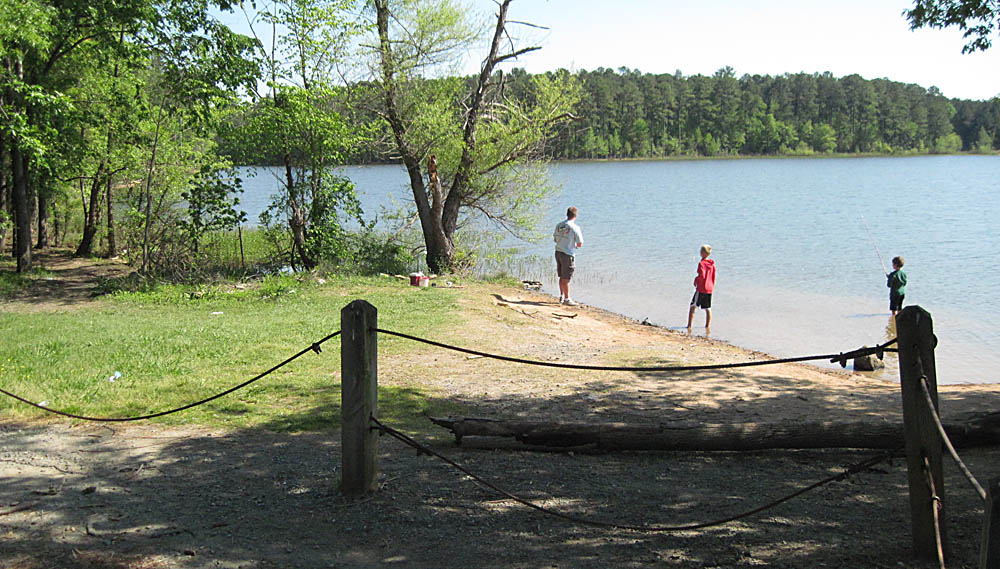
Parking - Bell's access: 35°45'8.85"N 79°
0'27.75"W
Kayak put-in location: 35°45'8.20"N
79° 0'25.13"W
On Farrington Point Road, 3.5 miles south of Farrington Point
or 1.2 miles north of US 64, turn into the lake access located
between the bridge and Bell's Baptist Church. The upper
parking area is large enough to maneuver a trailer, but the
lower parking lot is not. In the southeast corner of the upper
lot there is a wide graveled path to the lower parking area
and launch point for easy porting. There is no boat ramp here,
as this location was set up for fishing. At the east end of
the lower parking area is suitable access to the water for kayak
launch. It's been reported there was a sign indicating no boat
access here, and at least one kayaker reported getting a citation
for putting in here in the past. I checked the bulletin board
and all the signs around the parking lot and cannot find any
sign or notice against launching kayaks here. We have seen other
kayakers put in here and so far we have not been bothered by
anyone.

Suitable launch area at
east end of Bell's lower parking lot.
General Destination point: 35°45'17.48"N
78°58'8.31"W - White Oak Creek marsh area near Hwy.
751
Download the .kmz file for this location report (for
Google Earth) - TheCasualKayaker_JordanLake_Bell's-WhiteOakCreek_4-7-12
Download the combined .kmz file
for all location reports -
TheCasualKayaker_Combined_LocationReports.kmz
If you don't have Google earth, you can still view
the track on Google earth in this
window.


B. Everett Jordan Lake is located in the northeastern
corner of Chatham County, North Carolina. Access to this
part of the expansive manmade lake is easy via NC 751 or Farrington
Point Road from highway US 64 west of Apex, NC. Other ways to
reach it are on NC 751 from I-40 south of Durham, NC, and from
Chapel Hill, NC via Mount Carmel Church Road off US 501 at the
intersection of NC 54, NC 86 and US 501. Mt. Carmel Church Road
turns into Farrington Point Road which intersects US 64. (Note
that there is a village close-by spelled "Fearrington" Village,
but the road and boating access is spelled "Farrington". Don't
let that cause confusion when mapping or planning.)
This was our second trip to this marshy area. The first trip
was back in the summer when the lake was 2-1/2 feet lower
(214), and this area was only a damp spot. We couldn't get
close to the marsh. On this trip however, the lake was at
216.5 (6 inches above "full pool") and we could paddle all
the way east to where it was dammed by beavers. The ".kmz"
file (for Google Earth) for this trip marks the easternmost
terminus of our paddling where we reached the beaver dam at
three points. But I get ahead of myself.
The weather was just about perfect - sunny with a light breeze
off and on (upper 40's early, warming into the 60's later).
We finally got launched about 10:45 - a bit later than planned.
It seems there was a plethora of cyclists this day - more than
the usual gaggle peddling the highways around Jordan Lake. We
were only a mile from the access when we were stopped in a line
of traffic held up by a sheriff deputy while he directed cyclists
from an intersecting road onto Farrington Point Road. We sat
there for at least 15 minutes while cyclists trickled onto the
highway (some going one way and some going the other). Eventually
we were let through and continued on until we reached the parking
area and slowed to a stop, waiting for oncoming traffic before
making a left turn into the lot. While making the left turn,
some fool cyclist coming up behind me simply kept coming without
slowing, and began passing me in the left lane at full speed
while I was trying to turn. The whole time he was screaming
at ME to watch out. He never did stop, zipped on around me nearly
hitting me, and acting like it was MY fault! I don't know whether
he had no brains, no brakes, or didn't know how to use the brakes,
or simply thought he owned the road and didn't have to obey
traffic laws like everyone else. What a fine start to our otherwise
nice day of paddling.
I'll add a word of caution here - watch out for the cyclists
around Jordan Lake, as you will almost always find them in
nice weather. While most of them keep to the edge of the road
so they can be safely passed when it's clear, some of them
think they own the highway instead of sharing it with everyone
else.
Once we launched, we paddled east along the northern shoreline.
We took our time, in no rush, watching for birds as usual.
We saw Osprey, Cormorants, gulls, and several Great Blue Herons
(which are almost always present here). One of them was calm
enough to let me get a half decent photo of it up in a pine
tree.

There
were a few fishermen in boats all along the way, most of whom
were anchored and fishing. Boat traffic was minimal, with only
a couple of skiers during the day, but they kept their distance
and we had few wakes to deal with. It was a 2.25 mile paddle
to reach the marsh.

As we approached we came upon three Lesser Scaup who hung around
long enough for me to get a photo suitable to identify what
they were, though it's nothing all that great.

They didn't stay long though, so we paddled northeast a short
way among the brush. I stopped to try out a new anchor rig and
take a couple of photos, so the wife explored a little farther.
She came back and said she heard running water at one point.
I thought that was hardly likely in a marsh. I put away the
anchor and we moved on farther southward. Then we turned east,
following an open area to see how far we could go.

Before long we came upon the ducks once more. I took a couple
more photos, and tried getting some shots as they flew off.
I was still shooting into the sun, which did not make me such
a happy camper, though the shots came out half-way passable
anyway.


We wove our way between the brush and trees a bit farther eastward
until I realized to my surprise I was hearing running water
too.

Looking around I spotted beyond the bushes the glint of sunlight
on a small cascade of water. We paddled over to it to find water
spilling over what was obviously a beaver dam, with a "slide"
just a few feet away. The water level on the eastern side of
the dam was a good 12-16 inches higher than where we were on
the lake side.

It was a little after noon at this point, and the sound of trickling
water and the cool shade we found was so pleasant and relaxing
that we decided to hang out next to the dam and have our lunch.


When we finished our lunch we turned around and backtracked
through the brush to the open area, then paddled south a short
distance until once again we heard the trickle of water. We
followed it east to find another spot where water spilled over
the beaver dam near the south shoreline of the lake. After investigating
that location, we headed back across the lake, as the afternoon
was wearing on, and it was a long paddle back.

By now we'd been paddling for well over three hours, and the
breeze had picked up, fighting us on our way back, so we soon
pulled up on shore and got out to stretch our legs for about
ten minutes. Then we climbed in again and paddled on, hugging
closer to the shoreline to minimize the battle with the breeze
and choppier water. About half-way back to the launch point
we spotted an Osprey ahead of us diving a couple times, and
then it land in a tree right at the shoreline. I got out my
camera with the longest lens hoping to get a couple of shots.
As we came closer it stayed in the tree, eating its catch, seeming
not bothered by our slow approach. I clicked off a couple of
shots as we came up behind it and to my surprise it stayed put.

Hoping against hope it would continue to stay calm, I paddled
ahead trying to make my way against the wind and get in front
of the Osprey. Finally I thought I was far enough ahead, so
I turned the kayak to see that he was actually still there.
I pulled out the camera again and started firing away, floating
practically right under the Osprey. But after just four quick
shots the camera quit --- CARD FULL!! AAARGH. I had failed to
delete the images from my last two outings, and now the wind
was quickly pushing me closer. I frantically deleted several
images and grabbed the paddles to backstroke away, as by then
I was too close under it for a good shot. But by the time I
had backed away far enough, it tired of my antics and decided
to fly off to eat in peace somewhere else.


The photos were better than I expected, though not as sharp
as I'd hoped. It was a rare opportunity and I blew it to a great
extent because I'd not cleared the memory card. Live and learn
I guess. At least I got a couple of half-decent shots out of
it, though I know I can do better. I have to say though, bird
photography from a kayak in open water is really difficult.
It's hard enough on solid ground, but a drifting, bobbing, spinning
kayak is probably the worst choice ever. Of course, without
the kayak, I wouldn't have had the opportunity at all.
Once I finished kicking myself, we paddled the rest of the way
back and loaded everything up. All in all it was a nice day.
Boat traffic had been much less than we had expected for a Saturday
on Easter weekend, and the water level was sufficient for us
to reach our goal. I even came back with a couple of decent
photos.
I'll add a couple of last minute notes here about the .kmz file
- (1) I've included the GPS track of this trip in the .kmz file,
which appears to show the launch point on Google Earth as being
in the woods. Google Earth is a bit off on its satellite image
alignment. The track actually does start at the shoreline. (2)
I added the location of the beaver dam by drawing in a blue
line.
"If you're not paddling, you're not getting
anywhere."
|
|
|
|
| Article
Listing |
- Welcome
to "The Casual Kayaker"
- My
Rating System
- (B.
Everett) Jordan Lake - Farrington Point (northwest finger)
- June 18, 2011
- Paddling
in the Great Smoky Mountains, Jackson County, NC
- Bear
Creek Lake, Jackson County, NC, June 29, 2011
- Lake
Glenville, Jackson County, NC, June 30, 2011
- Wolf
Creek Lake, Jackson County,NC, July 1, 2011
- Kayaks,
Water, and DSLR Cameras - How I Manage Mine
- Our
first kayaks
- (B.
Everett) Jordan Lake, NC 751 area, July 16, 2011
- Hauling My Kayaks - A Little Do-It-Yourself
- Waiting
out the weather
- Short
Paddle on the Coast for Wild Horses
- (B.Everett)
Jordan Lake, return to NC 751 area, November 19, 2011
- (B.
Everett) Jordan Lake - Farrington Point to Morgan Creek
- April 1, 2012
- (B.Everett)
Jordan Lake, White Oak Creek marsh, April 7, 2012
- (B.Everett)
Jordan Lake, Vista Point - north, April 14, 2012
|
INTRODUCTION
When
I first began kayaking I found a most helpful blog
by Tom Haynie that aided me greatly in finding and
choosing new flatwater locations. His blog was infinitely more
detailed and useful than anything I found on kayaking forums.
I quickly resolved to share my own impressions of locations
I've visited, including details I believe to be important and
helpful, in hopes of providing practical information to others.
I sincerely hope you find something useful and helpful here.
(For more location reports visit Tom's blog at backshortly.wordpress.com)
|
Kayaking
Links
Paddling.net
- More Locations
Paddling.net
- Launch Sites Map
Download
Google Earth (free)
My Other Web Sites-
CarolinaWildPhoto.com
CarolinaOuterBanks.com
NCWildHorses.com
GossamerTrilogy.com
|
|